Monday, November 30, 2009

The NSE Infamous Hot 100

This list is now it's own "page" and can be reached from the tab near the top of the blog (or click this link). That is the one that will be edited and added to over time. 


Some of these will be explained in previous or subsequent posts. Others shall never be explained.
  1. Jay's coffee debacle, or, the reason that Rod is in charge of coffee.
  2. Jay being yanked off the rock ledge and the hat that wasn't.
  3. The winter storm that wouldn't be photographed.
  4. Bryan's bacon mishap.
  5. The missing butter disaster.
  6. Jay swims Otter Rapids and the birthday BJ.
  7. Rod's rod at Twin Falls
  8. Karrie and the pots.
  9. A bird between the canoes is worth...
  10. Joe in the ditch.
  11. South African doctors and a test of fidelity.
  12. Rod's Rock.
  13. Sunroof/beer shelf.
  14. The hot tub portage.
  15. Jimmy and the antics of the mysterious bent rod.
  16. Channel golf.
  17. Taking a fish for a walk.
  18. Three Circle Joe.
  19. Bryan sneaks the fish from between the local boats.
  20. Jay's trouble with footing, a bottle of pop and a toothbrush.
  21. Rod's generous contribution to the water bottle before the bike ride.
  22. Spooning in Weyakwin.
  23. Debate about which direction to drive (North or South during the snowstorm).
  24. Jay's five shots in five minutes.
  25. $25 soup at Nistowiak Falls.
  26. A compass and the three-day punchline.
  27. "Ummm... where do you get the firewood?"
  28. Farside Rapid wipeout and Rod's rescue sprint.
  29. Floating golf ball rescue.
  30. Roller portage debacle.
  31. Shit Island.
  32. Sauce 'n' Cake (with special mention of the first one).
  33. Losing free sunglasses in a thunderstorm (easy come, easy go).
  34. Mouse golf at Corner Rapids.
  35. Rod's endurance beer-swim below Twin Falls.
  36. Love Rock
  37. Lemon-pepper pickerel seasoning photo-op.
  38. Beaver dam overrun.
  39. Rod, Rob and the fishing licences.
  40. Jay and the sinking beer can.
  41. Bryan's rye donated for the cause.
  42. PA highway roller blader.
  43. The rock-throwing kid.
  44. Fishing tips from the RCMP.
  45. Jimmy and the un-glowing tree stump.
  46. Devil Lake night paddle.
  47. Going the distance on a record-breaking marathon day.
  48. Great efforts not to miss the game.
  49. Storm-bound under a log on Camp Island.
  50. The disappearing bottle of rum.
  51. 24km ride and a hang-over.
  52. Ken and the wardrobe.
  53. Sailing past North Falls.
  54. NSE and the AC/DC concert.
  55. Cinnamon buns and the bottom of a canoe.
  56. Rod disappears in the night...and reappears in the Land Rover.
  57. Moose on the Montreal.
  58. Touring backwaters in a borrowed canoe.
  59. Rod buys beer.
  60. Bryan's heroic down-island sprint to save Jay's hat.
  61. Filleting at the fishing camp.
  62. Bryan and Jay hitting the big stuff in Otter Rapids; Jay looking for bigger.
  63. Rob and Bryan's exciting passage below Twin Falls.
  64. The snowstorm.
  65. Bryan's dismal record in Otter.
  66. Running into the camp "owners" at Twin Falls.
  67. Unusual "flora" at the camp near Robertson Falls.
  68. Bush golf.
  69. "How frequently do they grade this road anyway?"
  70. A rental van and calendar anomalies.
  71. The excellent camp spot below Little Stanley Rapids.
  72. Free food Jimmy.
  73. Nistowiak Falls bubble bath.
  74. Which way is North?
  75. Toe surgery.
  76. Bannock burgers.
  77. Giant canoe-eating whirlpools.
  78. Bryan re-catches Rob's escapee fish at Clark Falls.
  79. The missing frying pan.
  80. Bacon grease as a concrete treatment.
  81. Jay goes off the 7m diving board.
  82. Where was Jay when Bryan really needed him, or, why communication before pulling a stunt is key.
It looks like we still have room for a few more adventures!!! Leave a comment to suggest an addition to the list.

    Tuesday, November 24, 2009

    2005 - Hayman Lake

    A version of the following was previously published on pawistik.blogspot.com.
    Hayman Lake, Churchill River Trip - June 2nd-5th, 2005 - #5 in our annual NorthStar Expeditions guys trips.

    We have yet to write a proper "report" for this trip. However, here are some things to note if we ever do a write-up:
    • The bloody Devil Portages
      • The portages had been trashed by wet weather and the Sask Centennial Canoe Quest which had gone through that spring.
    • The collapsing pack-frame
      • I had used an old external frame backpack, stripped down, to carry a food barrel or maybe the super-heavy duffel bags. Unfortunately, it fell apart part-way across one of the Bloody Devil Portages.
    • The hot-tub
      • We brought a hot tub with us on this trip. Across 2km or more of portage. Muddy, long portages. And, we did it without Jay even noticing we had a hot tub along.
      • OK, so the hot tub turned out to be not so hot. Mk II will be better!
    • The engineering genius that is Rod
      • Submersible stoves and other incredible feats of ingenuity.
    • Our buddy who visited and creeped us out
      • Don't worry, we confused him more than a little too.
    • Our bushwhacking adventure
      • We bushwhacked in to one of the lakes on Twolake Island. It was a grand adventure, full of thorn bushes, hordes of mosquitoes, a scenic little lake, but no fish.
    • Butter-flavoured Crisco shortening stays firm in warm temperatures and goes much farther than margarine does.
    • The wave-train of Sluice Falls that extended so far out across the small lake below the falls and above Farside Rapids that we had to paddle over half way across it in order to safely cross over to the carry spot beside Ric's Falls.

    View Larger Map


    The photos are all courtesy of Rob.

    Another year of high water on the Churchill River, evidence to go with the above graph:


    Getting ready to hit the water:


    Beer & lunch break along the portage:


    Little Devil Rapids:


    Rod getting the hot tub ready:

    The heat is supplied by an aluminum "submersible" stove made by Rod. It's fed through the rectangular opening on top.

    Waiting for the hot tub to warm up:


    One of the issues we had was that the aluminum stove floated, just like Rod's aluminum canoe. We tied rocks to the bottom to keep it from tipping over and putting our fire out (again).

    Golf balls on the stove legs keep them from poking holes in the tub bottom:


    Jay feeds the fire:

    Another issue we had with the stove was due, largely, to the small size which required us to feed it with very small sticks. The fire never really seemed to get roaring with it's own momentum. This could have been made worse by it being submersed  in cold water.

    Still waiting:


    Bryan gets brave and tries out the tub:


    Jay's turn in the tub:


    Rod tends the other fire:


    Clark Falls on the Weaver River where it flows into the Churchill River at Hayman Lake:


    Rod and Jay fish at the base of Clark Falls:


    Jay with some fish Bryan probably caught:


    Bryan with a fish Rob had caught a day earlier and which had escaped:


    Better weather at Clark Falls (must have been the second day):


    One of the locals:


    Part of the neighbourhood:


    Jay and Rod relax at our island campsite:


    Surf City on the way out:


    Rod and Jay coming through Surf City:


    Lunch break on Barker Island during the paddle home:


    Scouting Mosquito Rapids:


    That's the end of the trip!

    Follow up note - I found this in our e-mail records while searching for something else. Jay was commenting on our gear list and had this to say:
    The only suggestion I would have is that we try to cut back on something, as we were very tight [in the vehicle] last year.  Maybe just one tent and a couple blankets??
    Ummm...., yeah sure Jay, we'll cut back all right, and we'll just throw this inflatable pool and stove in too.

    Monday, November 23, 2009

    Running Robertson

    Here is a video I came across on Youtube some time back that I'd like to share with you. This fellow ran one of our popular destinations, Robertson Falls, in an open canoe. Inspiration for next year's trip!

    Monday, November 16, 2009

    2004 - Robertson Falls

    The following trip report was previously published on pawistik.blogspot.com.

    Churchill River, Missinipe to Robertson Falls - September 9-13, 2004
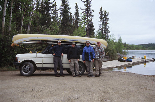
    Annual NorthStar Expeditions guys trip with Bryan, Rob, Jay, and Rod. For Rob's photos, follow the link.

    After replacing the motor for the windshield wipers in Rod's Range Rover, we loaded up and headed off with abandon into ... a blizzard. Yup, that's right, a blizzard on the night of September 8th and we were heading straight into it at 1:00 am with 2 canoes strapped to the roof.

    We got away late, much later than we expected. Let's blame Rob for not anticipating that it was going to take several hours to fix Rod's vehicle (we anticipated that the weather might be bad enough that we would need his windshield wipers) and for not getting Jay there sooner so we could have had more hands getting in the way, and for not having Rod's vehicle loaded with the canoes and ready to go earlier. So, at the crack of 9 pm we headed over to Rod's house to deliberate and reconsider our options, and maybe have a rum to ease the thought process. The forecast wasn't looking good - cold, wet, and maybe even white. A similar amount of driving in the opposite direction would have landed us in Montana and a land with a forecast of near 30C temperatures. We scoffed at cold with only a minimal amount of whimpering and hit the road heading North at around 10pm. Fill her up with gas and onto the open highway. By 11:30 we were in PA, filling up with gas again (ummm..... is this a bad sign guys?). Back on the road we were peacefully enjoying the ride up when one of us noticed that the rain seemed to have gotten harder, and whiter. Shit. It's snowing. Rod casually points out that it had been doing so for a while and we hadn't gone too much farther before it turned into a full snowstorm. Once we arrived at the Waskesiu turn-off we decided to pull in, go over the map and reconsider our options and have a beer in the closest bar to keep us perky. After only a little whimpering (mostly from Jay) we decided there was nothing for it but to keep heading North. By now the snow had accumulated and the roads were getting worse. We eventually reached Weyakwin Lake around 2 am and decided to call it quits for the night so we pulled into the winter wonderland looking for a place to set up our tents for the night, wondering if they would handle the snow load. Things were not looking particularly good at this point with about 6" of heavy wet snow everywhere. We found a gazebo (which apparently doubled as a recycling depot) near the community centre and after moving aside some tables and a couple of garbage bags full of beer cans we set up one of our tents in this tiny parcel of snow-free ground. Some rum, brandy, and rye was consumed while we considered our current situation and the prospects for the morning. We slept while the snow continued to pile up around us.

    Day 1- Friday, September 9th - The next morning in the daylight we were finally able to take in our winter wonderland. We packed up and hit the road bright and early (possibly even by 9 am!). Driving the gravel road back out to the highway we saw thousands of trees broken, snapped in half like toothpicks under the weight of the snow. Back at the highway, we again deliberated and considered our options - North or South? After 10 minutes parked at the intersection we eventually decided to throw caution and all sense of reason to the snowy wind and continue North. Part of the reason for this decision may have been the amount of money we put into fuelling the vehicle thus far. Our decision made, we headed across the road to fill up with gas ... again. In the gas station/general store we heard tales of the power outages and line fires that had occurred. It seems that the snow weighed the trees and power lines down so much that they would touch each other and start fires. Back on the road we noticed after about 10 miles of driving that the snow was no longer quite so deep. Soon, there was no sign of the blizzard we had just been through. Things were looking up!

    We made a short stop in Air Ronge for gas (of course) and a visit to the local hardware store to stock up on whatever items had been forgotten, as well as adding a bunch more cold-weather gear to our arsenal. My personal addition was a pair of insulated rubber boots. It would prove to be a wise selection. With lunch of greasy La Ronge A&W burgers under our belts, we were off on our final leg of the journey northward. Thankfully, we didn't see any near-dead guys in the ditch this time around. We parked and put-in at the provincial campground at 
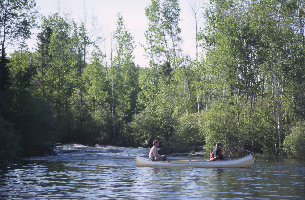
Missinipe and after only a minimal amount of confusion we were underway on Otter Lake.


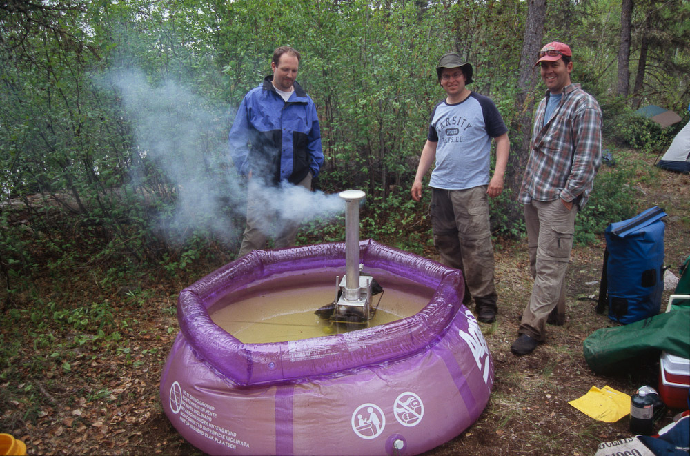
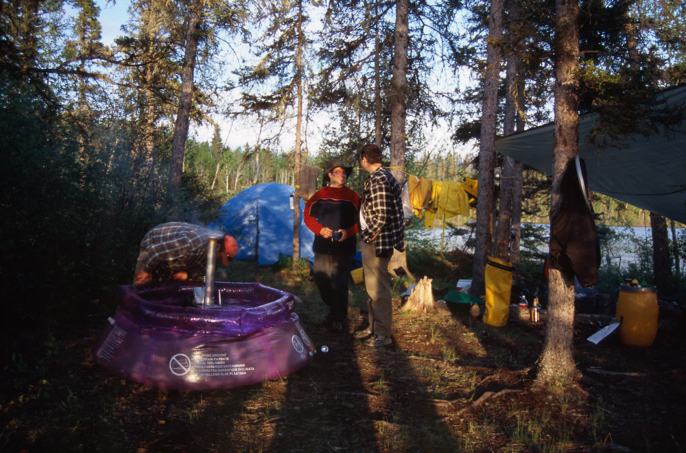
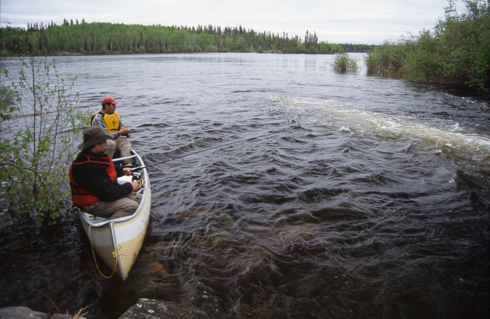
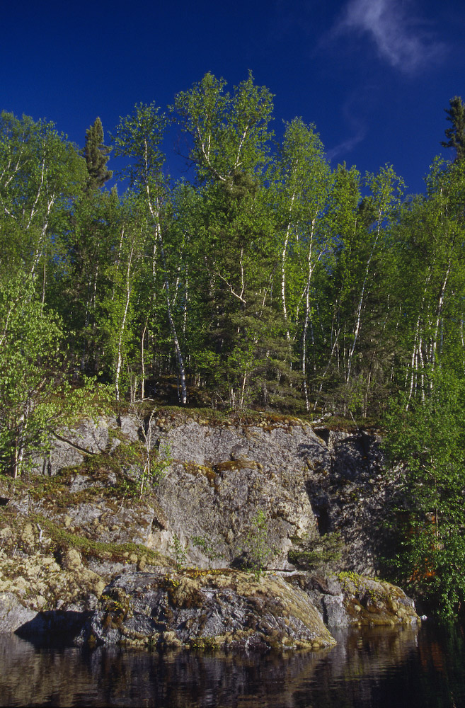
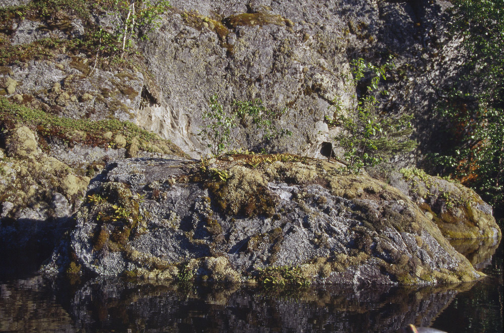
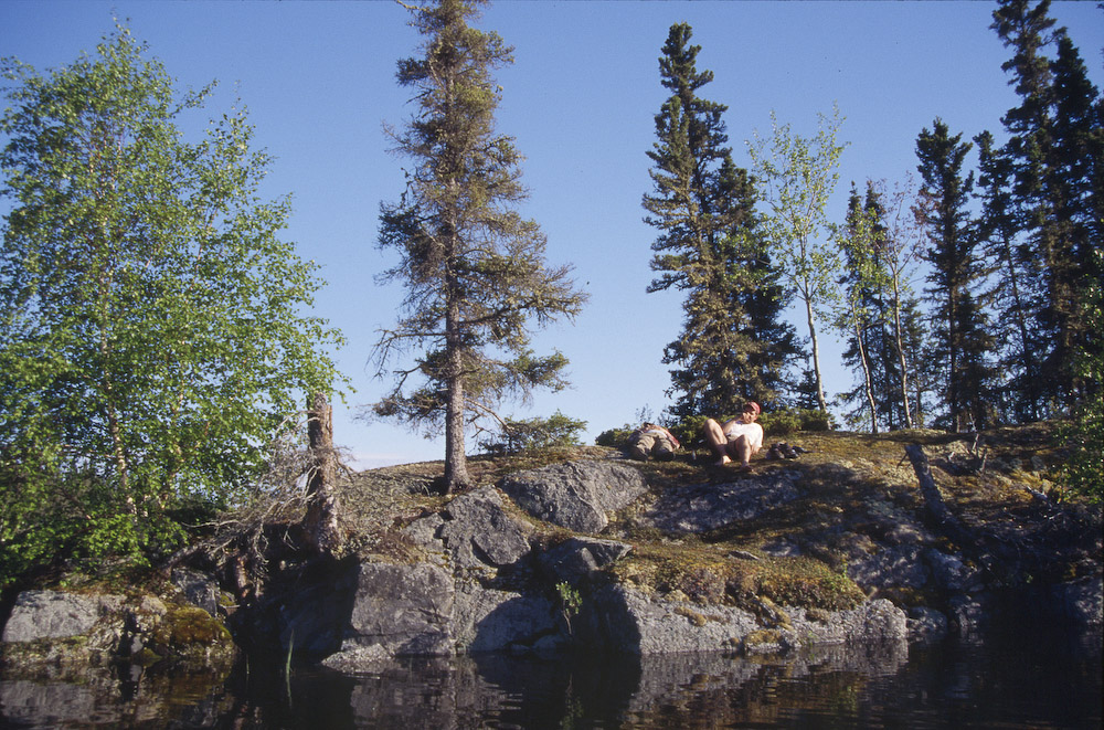
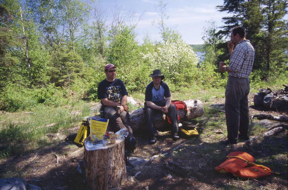
    We headed generally East across Otter Lake, navigating our way through the network of islands and bays. A couple hours of paddling in calm conditions brought us to Naheyow Island which we went to the south of. There is a channel to the south of this island which seems to see less traffic than the MacDonald Channel to the north. There is a riffle to pass through at the western end of the channel and a couple of campsites were indicated on our maps for this area. We found our campsite in this channel just beyond where it takes a 90 degree turn to the northeast. The campsite is well used but in decent condition with a good supply of firewood not too far back into the bush. It proved to be a much nicer campsite than the one located right at Robertson Falls, and much less traffic is seen in this part of the channel. There are enough tent spots for a fair size group (room for at least 4 tents, probably a few more). With our camp set up, we finally got around to having lunch, at what was probably 5 pm by that time.

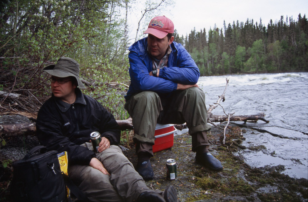
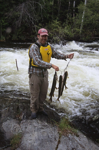
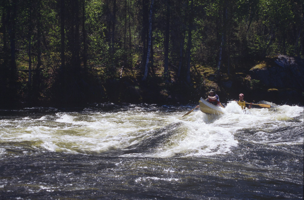
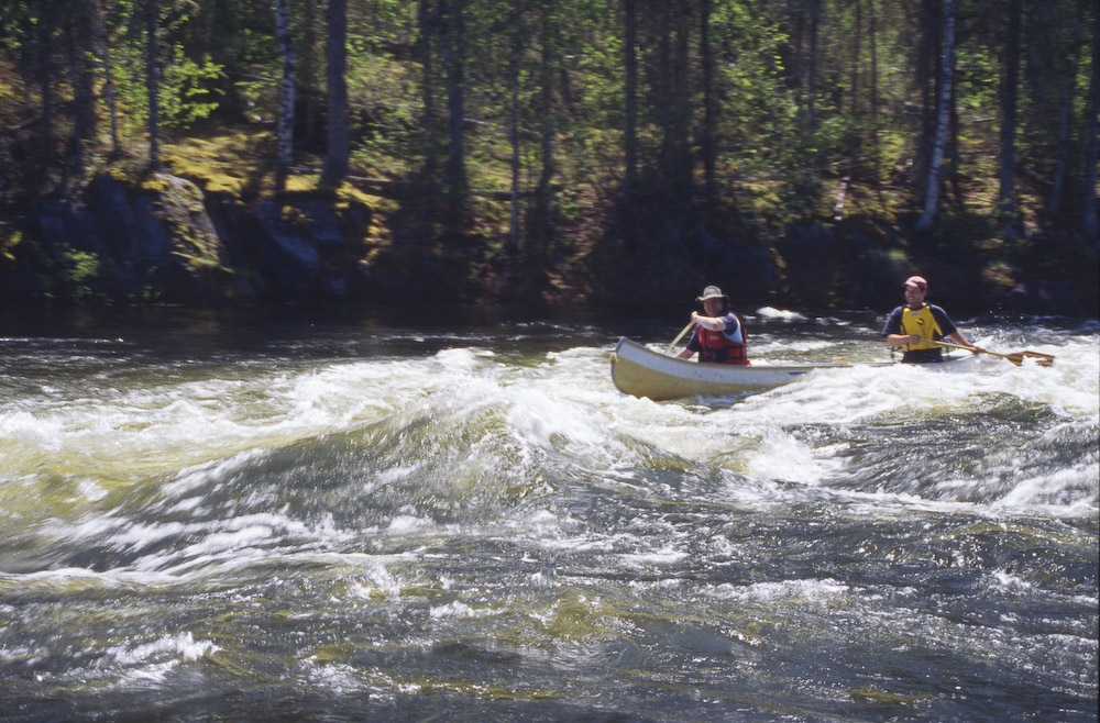
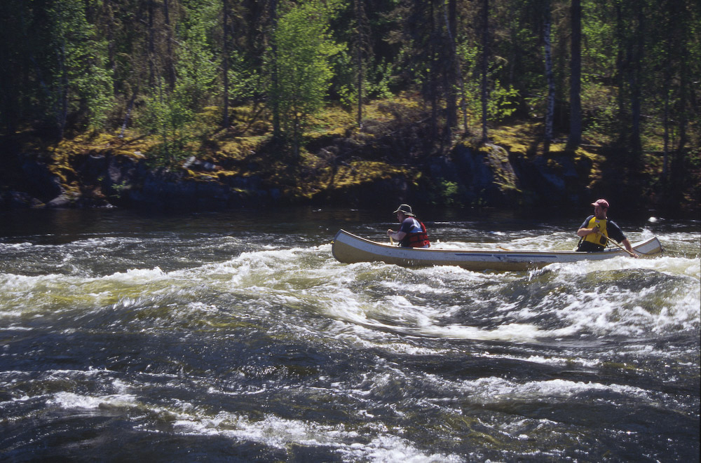
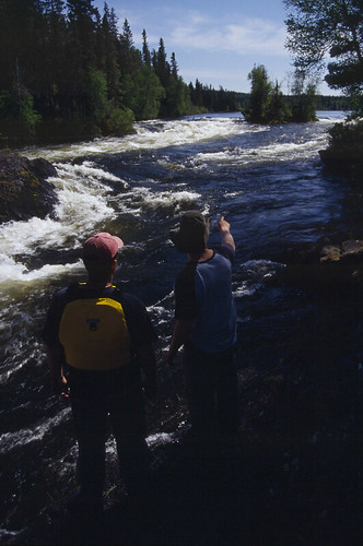
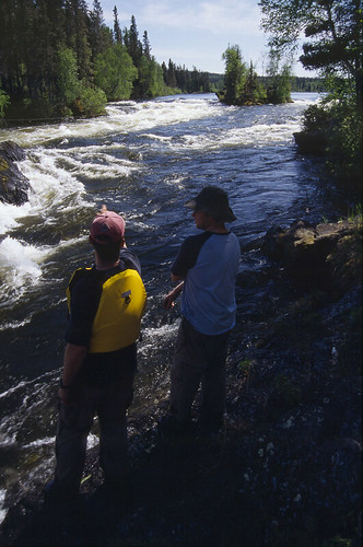
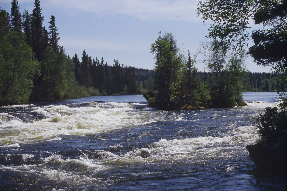
    Day 2 - Saturday, September 10th - We took a tour over to Robertson Falls (2 km direct, 2.75 km by water around Reid Island) to do some fishing and to check out the neighbourhood. We fished from the portage east of the falls without success before heading out on the unnamed lake below the falls. We went to the west, upriver into the area of the confluence of the channels around Reid Island. This is a very nice area that looked like it should be home to some great fishing. As I recall though, we had moderate success here at best. We then landed our canoes on the island at the head of Twin Falls. After bushwhacking across this island (236 m straight across, more like 400 m after zig-zagging around obstacles and looking for a passable route), we were so impressed by the spectacle of Twin Falls that we bushwhacked twice more to bring back our rods and gear. There is no real path and it's not an easy trek, but it was very much worth the trip. Not only was the view great, but the fishing there was decent too. We pulled a few pickerel out of the fast turbulent waters at the foot of the multi-channel falls. We then headed home to enjoy our fresh fish for supper. We got back to camp under threatening skies and got the tarps up just as the rain started to fall. With tarps up and a fire going, Rob and Jay got supper preparations while Rod and I donned rain gear and headed out into the darkness and rain to fillet our supper.


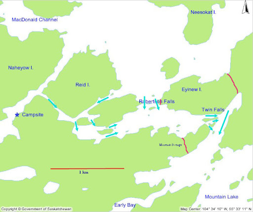
    Map showing Reid Island and the Robertson Falls region of the Churchill River. Water flows in the directions indicated by arrows. Note that there is till a whole other set of falls and rapids to the North that flow out of Otter Lake and into Mountain Lake.

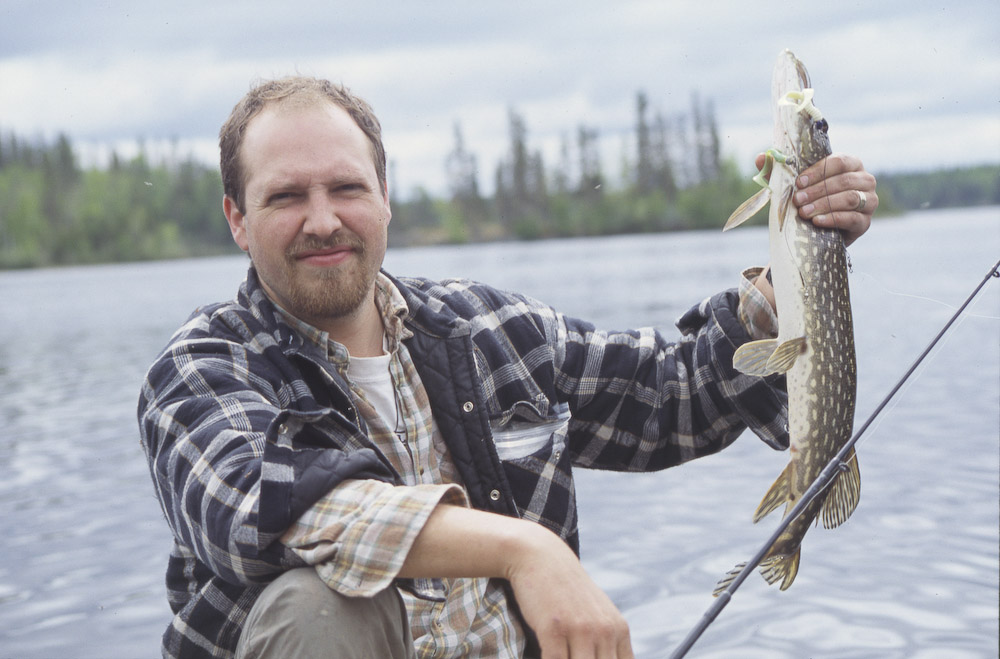
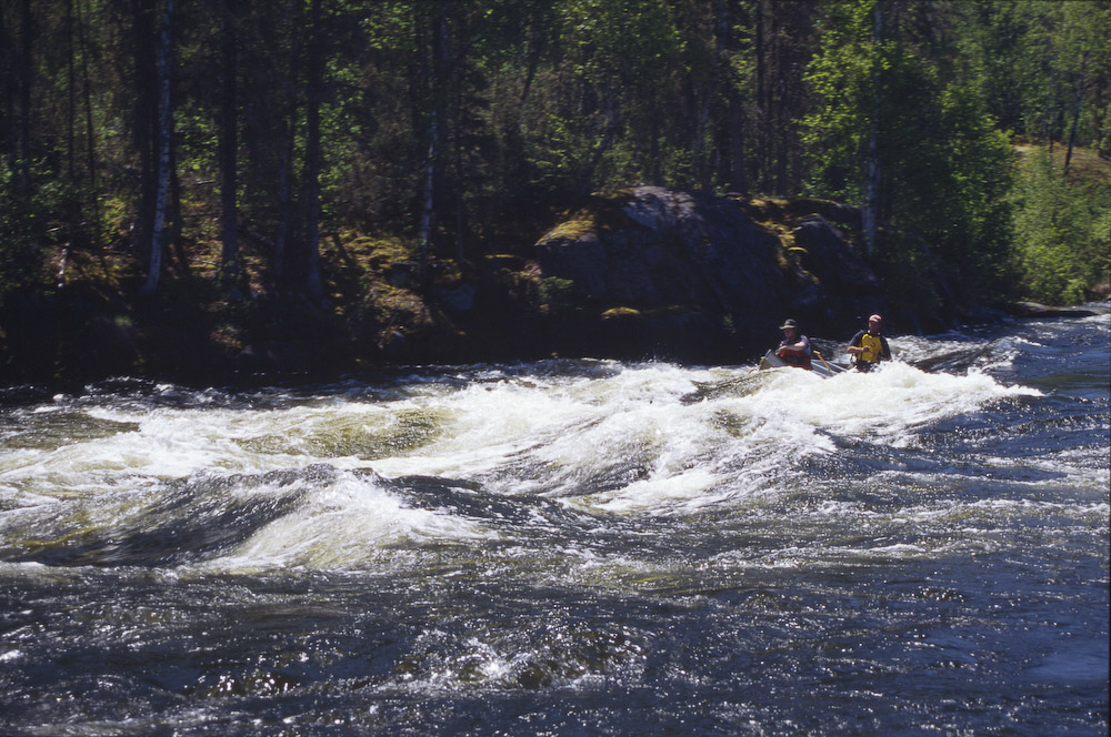
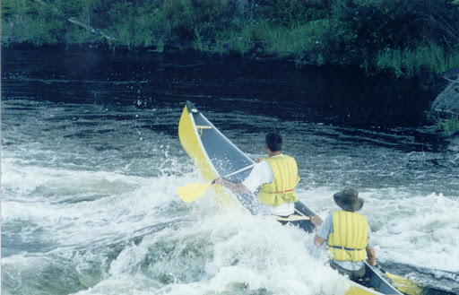
    Day 3 - Sunday, September 11th - We started the day with a great debate regarding where to go. We had 3 options: 1) Head north into Rattler Bay and Rattler Creek. There is a pictograph there that we would like to have checked out. 2) Head northeast to First North and Second North Falls at the other end of Eyinew Island where the remainder of the Churchill River flows out of Otter Lake and into Mountain Lake. 3) Portage below Twin Falls to fish below the falls and explore a bit of Mountain Lake. Being ready to go, we realised Rod had left his fishing rod at the island above Twin Falls. We eventually decided to head to Mountain Lake by a route that would allow us to pick up the misplaced rod. Rod and Jay took the route which had them portage past Robertson then after picking up the rod, traverse into Mountain Lake via Mountain portage. Rob and I decided to take the single portage (350m) directly into Mountain Lake that cuts across a peninsula on Eyinew Lake. This single portage was steep at the Mountain Lake end and we had a time to get the canoe and ourselves down the slope given the damp conditions. Once in the small bay Rob and I paddled below Twin Falls through some waters that could accurately be described as turbulent and confused. The water comes straight off the falls, hitting the wall along which we were paddling. A lot of that water makes it's way into the bay then flows back out to Mountain Lake. Water in that area is going every single direction which makes negotiating it in a canoe tricky and it should not be attempted by novice paddlers. If you do venture though here, keep steady and stay a safe distance (10 feet?) away from the rock face. You may be tempted to stay tight to the rock since there are standing waves further out, but in my opinion the smoother water along the rock is a wolf in sheep's clothing. The waves are at least a bit more predictable and indicate water flowing towards Mountain Lake instead of water that is going downwards. Of course the nature of this area may be very different at a different level of river flow so your experience may be markedly different. Once through this area, we met Jay and Rod at the dock of the nearby fishing camp. After checking out Mountain Portage, Jay and Rod opted to take the shorter route through the fishing camp which was closed for the season. After lunch on the dock, we headed back to the Twin Falls area to fish. We picked up a few walleye and a couple of sauger here, though the sauger were too small to keep for supper. This was the first time any of us had seen a sauger and there was some some discussion about whether it was simply a small dark walleye or something else. Sunset came while we were on the rocks facing Twin Falls and we were treated to an incredible display as the sun peeked through the clouds and shining on us from directly above the falls, through the opening in the trees created by the channel. It was an incredible sight in a beautiful area, such that even though we knew we'd better get back to camp quick, we were slow to drag ourselves away. Plus one of us was away down the rocks in another area and couldn't be found by the others. When we tried to regroup Rob, Jay and Rod headed to where they thought I was. Meanwhile I headed back to where I thought they were and back to the canoes. In so doing, we managed to unknowingly cross paths just a few meters apart with me in the bush and the other three on the steep rocks. As a result we were all very confused about where the others were. We didn't get to tour as much of Mountain Lake as we had wanted but we had a great afternoon at Twin Falls. It was very dark by the time we had made it back into our home channel so it's a good thing we knew where we going.

    Day 4 - Monday, September 12th - We packed up and headed home across Otter Lake in a moderate wind. Due to the SW wind we opted for take a more northerly route through the islands in order to seek as much wind protection as possible. This made for a nice variation on the route so that we covered some new ground and saw some new sights. Back at Missinipe we quickly loaded up Rod’s vehicle and headed south. As usual it was late at night by the time we got back to the city, unloaded the Range Rover, and got everyone home.

    Follow-up comments: The most adventurous part of this trip may have been the drive North. We seriously considered turning with our tails between our legs and heading for a cabin. If we had, we would have missed Robertson and Twin Falls and some beautiful country we all want to go back to another year. We had cool but mostly dry weather which turned out OK. It was another example of a decent trip despite a horrible forecast. If it had been raining the whole time, or there had been 6" of snow on the ground as we expected, it might have been quite a different story.


    Note in the above graph that there was no snow on the ground recorded. That would have been a much different situation had the weather station been in the Thunder Hills near Weyakwin.

    November 2009 Addendum: We (NSE) went back to the same campsite at the east end of Otter Lake once again. This year we toured the North Falls route, visited Robertson and Twin again, and did some fishing. We also started off the trip by paddling the Montreal River before continuing our drive north. I'll post a report on that trip sometime in the coming months. A post for that trip is can be found here.

    Friday, November 13, 2009

    Paddling Lessons From Dummies

    How not to run a simple but narrow rapid.

    Wednesday, November 11, 2009

    2003 - Corner Rapids Canoe Trip

    The following trip report was previously published on pawistik.blogspot.com.

    Churchill River, Corner Rapids. September 2003. 
    Four of us (Jay, Rod, Rob and Bryan) went up to Corner Rapids on the Churchill River for 4 days on the weekend of September 4-7 as the third annual NorthStar Expeditions trip. The weather was fantastic, the fishing periodically very good, the water very warm, the northern lights briefly amazing. For Rob's pictures, follow the link.

    The adventures started on Thursday morning while driving North on the gravel. We crested the top of a hill to see a blazer overturned in the ditch, a semi stopped on the side of the road, and a guy named Joe lying at the side of the road looking dead. We stopped and the semi had already radioed for help and one other vehicle had started the drive back to La Ronge looking for help (the semi couldn't reach La Ronge directly but was trying to relay the message by radioing other trucks). Joe was in fairly rough shape and crawled to the side of the road after having been thrown from the vehicle (we think). He was conscious though and of course I decided to put to use the remnant of 1st aid I could remember and felt him up looking for sore spots and protruding things. Only later did I figure out that the other guy on the scene had already done that. It turned out that the other guy was a fire fighter from La Ronge. It didn't take too long after that before we figured out that we were just going to be in the way when the ambulance arrived.

    We eventually got to Devil Lake and underway without further mishap. We portaged around Mosquito Rapids, paddled across Barker Lake, then paddled, dragged, carried, lined and portaged our way up the Rapid City channel towards Corner Rapids. While the 4 of us were trying to line Rod's loaded canoe up one short but large rapid, the canoe got swung out into the current and yanked downstream after having filled 1/2 full with water. This was not entirely unexpected and wouldn't have been much of a problem except that Jay had the rope wrapped around his hand so got yanked off the rock and unceremoniously launched into the water. The canoe by that point was completely swamped but stayed upright so kept most of the gear contained. Rod and I ran to my canoe, hopped in and started the recovery process (abandoning Rob on the other side of the river). A couple of 'merican fishermen watching the whole misadventure went around picking up the few loose items that had floated off (the jug of golf balls, a food pail). All told the only thing lost was Jay's sunglasses (free from the Air Ronge Mohawk with a fishing licence), which we suspect are on the rock near where Rob picked up Jay's hat - he was yanked off the rock so fast that his hat fell where he once was standing.


    Having decided to portage around that rapid, we were able to line/paddle the rest of the way to Corner without further mishap. We camped at the bottom of Corner Rapids which turned out to be a very nice spot and the day was topped off by a steak supper with Rod's special marinade (a can of coke, mustard, garlic, and various other spices). That night we were sitting around the campfire when Rob pointed up to the northern lights and said "holy shit, look at that". As a result I was stumbling around in a circle looking up at the sky when I stubbed my toe. I didn't think much of it at the time but after it still hurt about 15 minutes later I checked my toe and it was bright blue. It only got worse as the weekend went on and by Saturday morning it was very swollen. I eventually decided to take Rod's advice and release the pressure. I took a fish hook, bent it straight and cut off the point, then heated it over the stove until it was red hot. I then used it to melt a hole through my toenail. I was rather apprehensive but it didn't hurt at all and it did feel at least somewhat better afterwards.*

    Friday we spent the day touring around the area below Sluice Falls and fishing. After a few small pike in the morning we were skunked for the rest of the day. We were starting to wish we had kept those first pike since it was looking like a supper of fish batter patties fried in butter. That's about when I caught a 10 lb pike. None of us had a net so I had to wrestle it into the boat. 10 lbs might not sound like much but that was a big fish. It fed the 4 of us quite well and we did not have to go hungry.

    Saturday we decided to play in the whitewater and decided Farside Rapid was the best one to start on. Farside is on the far side from Corner (i.e. river right) and is a big rapid that we played on when we were up there on previous trips. The water level was fairly high so the waves were nice and big. Rob and I went first while Jay and Rod watched from above. The first wave we hit sent Rob way up in the air, then hit the canoe at an angle, knocking us a bit and causing us to take in some water. We then rode out a few more of the waves but started to get knocked around a lot and took on more and more water. We eventually capsized and went for a swim. The current does some funny things there and Rob says he was pulled under for a bit. After floating in the current for a while the eddy nicely deposited us on the rocks on the right side. The canoe continued upriver in the eddy back-current before coming back for another loop. I jumped in after it and grabbed the rope and once I was standing on shore I was able to pull the canoe onto the rocks as it passed us for the second time. This time the only thing lost was Rob's hat (he also lost a sandal and a paddle but we picked those up in the bay around the corner thanks to Jay's swimming efforts and in spite of my efforts) and the canoe suffered not a scratch. After watching us, Jay and Rod quickly and wisely decided to carry over the rocks rather than suffer our fate in the water. After that episode Rob was somewhat nervous and I was less anxious to continue running rapids that afternoon. While paddling back across the current near where the Farside current and the Ric's Falls current come together, a big swirling hole opened up right in front of Rob and I. It was probably 20 feet across and 2 or 3 feet deep and seemed like it was about to swallow us whole though we were able to skirt it's edge. One second the water was fairly flat and moving in a straight, predictable manner; the next this giant swirling chasm was opening immediately in front of us. I had never seen anything quite like it before, at least not from so close up and it was pretty freaky especially given what Rob and I had just gone through.** Instead of playing in more rapids we fished from the point off our campsite and found a whole bunch of tasty pickerel (figures, we spent the previous day touring all over the place trying to find fish only to have them on our doorstep). It was beautiful fishing, standing up to our knees in the warm water and casting into the current with the sun shining.


    The above is from a previous trip. My brother and I on the wave where Rob and I wiped out.

    Thankfully, Sunday was free of misadventures. We packed up and ran the rapids all the way back to Devil Lake. Jay even introduced me to the Three Sisters Rapids and Staircase Falls, none of which I had seen before. This side channel allowed us to bypass Mosquito Rapids to the South and instead do just a short carry around Staircase Falls to get back to Devil Lake. Once back at the campgrounds we loaded all the gear into the van and paddled over to Otter Rapids to run through. Rob, still a bit gun shy from the previous day, chose instead to record the event on film. When I went through with my canoe and Rod in the bow, Jay insisted on kneeling in the center and bailing for us. He said it's the only way to get down without swamping. I'm still not convinced. The boat was much more tippy with the extra weight and higher center of gravity. We took on a lot of water and Jay bailed a lot out, but I'm not sure we would've taken on so much without him there in the first place. I guess we'll just have to set up a whole series of randomized, replicated trials next year to figure it out for certain.***

    The table below summarizes the weather as recorded in LaRonge, about 80km away to the South. It was pretty great.
    The chart below shows the water levels for '03. Levels were pretty low, that's probably the lowest water I've seen on the Churchill (the last several years have had predominantly high water with records being set in '09 and a few years ago).


    Things I haven't mentioned: 
    1. Butter, not enough about the butter. 
    2. Bear poop: No mention of the mountain of relatively fresh bear poop in the middle of our camp site. 
    3. No mention of the road grading schedule that we confirmed (but have since forgotten the answer to).
    4. No mention of the longest drive competition that I won.

    *Footnote: (pun intended) Once I was back home the swelling in my toe returned and I went to a doctor to have a professional look at it this time. He confirmed that what we did in the bush was the right thing to do, and he repeated it in his office, this time using a fine electric soldering iron instead of a fish hook heated over a camp stove. The toenail fell off two weeks later and took over 6 months to fully re-grow.

    ** Here's what Laurel Archer has to say about Farside Rapids in her excellent book, Northern Saskatchewan Canoe Trips, A Guide to Fifteen Wilderness Rivers: "The [river right] rapids are the Far Side.... This class 2+/3 chute is fast with a long, large wave train to follow. There is a violent current, making boils and whirlpools. Again, good walleye fishing from the island." We could've drowned but at least the walleye would've picked our bones clean.


    *** Jay's response "You didn't see the water in the canoe when Rod and I went down, I'm convinced that we need about 20 trials next year to confirm."

    Sunday, November 8, 2009

    Another Group on the Montreal

    In September, NSE ran the Montreal. That's a story deserving of it's own post which will come in the not-too-distant future. In the meantime, this little video will give you a taste for the Montreal River.


    I think we'd get along with those intrepid explorers just fine.

    Thursday, November 5, 2009

    Survival Tips

    I came across this recently and thought it was pretty damn funny: http://www.27bslash6.com/lost.html. It's a list of survival tips that will be very useful for all members of NSE trips to have memorized and practiced well.

    An example from the indispensable list:
    Survival Tip #1
    If you have water with you, drink it all immediately. There is a good chance you will be rescued before long so it is pointless being dehydrated. If you do run out of water, the trick to finding more in the wilderness is to remember that water always flows downhill. Find a hill and wait at the bottom. I read somewhere that if there is no water available, you can drink your own urine so I always take a two litre bottle of it wherever I go just in case.

    Wednesday, November 4, 2009

    2001 - Nistowiak Falls by Canoe: NSE Inaugural Trip

    Portions of the following was previously published on pawistik.blogspot.com.

    Churchill River - Stanley Mission to Nistowiak Falls. June, 2001 
    The inaugural NorthStar Expeditions trip! Easy 4 day canoe trip.

    For more information about paddling this trip see the books Northern Saskatchewan Canoe Trips by Laurel Archer, and Canoeing The Churchill River by Marchildon and Robinson. This trip is also described within the Sask Documented Canoe Route #12

    We had a lot of fun on this trip and it whet our appetite for more. As was to become the pattern for later trips, we were later than we hoped getting away from the city. We made Stanley Mission without incident and parked our vehicle in the parking lot of the Northern Store, paying at the store a per day fee to ensure the protection of our vehicle. We're not sure what sort of protection this fee offers as there is no fence, no security of any sort, but it does seem to be the convention for trippers departing from Stanley to pay the $6 for peace of mind.

    After a brief stop at the nearby Holy Trinity Church, we were on our way down the Churchill River. By that time it was already getting later in the evening and we began to look for potential camping spots almost immediately. Being the first time through the area for us, we didn't find anything. We eventually pushed a very poor campsite into the thick bushes just above Little Stanley Rapids. That night, we had a small fire and accidentally drank way too much of a bottle of Jaegermeister, and probably some Stroh. The next morning, somewhat bleary eyed and worse for wear, we peaked through the thistles and bushes to see ... a well-groomed, well-used campsite, complete with fire boxes, just a few yards from our spot in the brambles.

    We set-out again, no doubt at a very slow pace, running Little Stanley Rapids (there is a roller portage available) and continuing across Drope Lake we came eventually to the narrows where the Churchill River flows into Nistowiak Lake. Although we had only come about 5.5 km (normally about 1 hour of paddling), we decided that  an island nearby would be suitable as a campsite. In fact, we were hit by a squall just after reaching the place we came to call "Camp Island". We took shelter from the hail and downpour sitting underneath a tarp draped over a large log. Camp Island is a convenient, if rather small, camp spot several kilometers (3.4 km) from Nistowiak Falls. Since the location gave us fairly easy access to the falls, easy access to the narrows where we anticipated good fishing, and an easy return paddle to Stanley, we decided it would do. A few meters away was "Shit Island", which is where you had to go to take a crap since there was very little room for that on Camp Island. You won't find these names on anybody else's map by the way.

    Nistowiak Falls was amazing, I highly recommend paddling there at least once. We had good fishing at the base of the falls on Nistowiak Lake so we ate well that night back at Camp Island. We hiked not only to the top of the main falls, but to the very start where the Rapid River flows out of Iskwatikan Lake. I believe we also fished at the top, and in the pools near the top, but I don't recall having much luck there. We did however lose several hooks to some sort of steel structure that was a couple of feet below the water surface in that spot. As a side note, I heard of a floatplane once going over that topmost portion of Nistowiak Falls, a drop of several feet. That couldn't be good for the airplane, but it would be better than going over the falls themselves. My friend Branimir has taken some very nice photos of Nistowiak Falls, including this one. See also the Karpan's web site for more Nistowiak photos. (I'm sure Rob has some good photos too, so let's talk him into sharing them with us, eh?) I think this would make an excellent destination on ski or snowshoe too, and I've heard rumours that the Saskatoon Snowshoe Club has in mind to travel there this year.


    On our return trip home we had a bit of adventure while crossing the Little Stanley Rapids portage. This rapid is bypassed by a roller portage - a boardwalk portage with rollers set into it. Boats are pulled up onto the rollers and can be nicely rolled along rather than carried. Like all portages, this one has an uphill and a downhill section. Rob and I had the great idea that it would make for a smooth and elegant launch if we boarded the canoe rolled into the water. What ensued was anything but! You see, with Rob and I on board and ready to roll gently into the water, Jay and Rod decided we could benefit from their assistance. However rather than guiding us gently toward the water, they ran the 20 or 30 feet as fast as they could, and pushed the canoe as hard and fast into the water as they could manage. With the speed and angle that we hit the water, the bow made a mighty splash and dove deep down. Unfortunately, Rob's camera case containing several hundreds of dollars worth of camera gear was open on his lap. Fortunately, the impact of the canoe largely splashed the water away from the hull and we took on much less water than it seemed we were going to. In the ensuing confusion, we were able to avoid being swept down Little Stanley Rapids sideways. One of these days, when they little expect it, Rob and I intend to return the favour to Jay and Rod.

    Tuesday, November 3, 2009

    The Trip List

    To date there have been 10 years of NSE trips. This list is an attempt to sort them out:

    2001: Nistowiak Falls
    2002: Barker Lake (without Bryan)
    2003: Corner Rapids
    2004: Otter Lake, Robertson Falls
    2005: Hayman Lake - Year of the Hot Tub
    2006: Mountain Lake, Robertson Falls
    2007: Corner Rapids - Year of the Hot Doctors
    2008: Barker Lake - Custom Whitewater Instruction
    2009a: Nesbit Forest - Winter Trek
    2009b: Otter Lake, Robertson Falls
    2010: Churchill River - Sandfly Lake to Missinipe

    As the trips get posted to this blog, the list will be updated with hyperlinks that will take you to the details and report (if written). We fully expect this list to continue to grow for years to come.

    Monday, November 2, 2009

    Welcome to NSE! An Introduction


    Welcome to the NorthStar Expeditions blog! This blog has been created to serve as a record for the adventures and exploits of NSE. Stay tuned for trip reports, irreverence, commentary, photographs, and general bs. This coming year is the tenth anniversary of NSE so it's only fitting that at this time we take a look back at some of our past fun and adventure.

    Who We Are
    North Star Expeditions is Bryan, Rob, Jay, and Rod. Just 4 average middle-aged guys who get together for an annual canoe trip. Our trips have all been to north-central Saskatchewan and usually feature whitewater and fish. Our destinations have most frequently been on the Churchill River in the region around Missinipe and Stanley Mission. Recently, we've started to expand our scope to include self-propelled winter activities. We don't take ourselves very seriously, nor does anyone else. We are all married with kids (sorry gals) and our families are good friends who also camp and visit together regularly.