Wednesday, September 22, 2021

2021 20th(ish) Annual Trip - Weaver River

As usual, this year's canoe trip was another great one. This was our 20th annual trip for the four of us who call ourselves Northstar Expeditions! Actually 20th annual is the average - Jay has completed 21 trips and has never missed a year, Rod and Bryan each have missed one year (hey, I had a daughter born and a thesis to defend), and Rob missed 2 years. Because of the special(?) occasion, we had decided that we needed to extend the trip by a day compared to typical, and to splurge on the flight. The Weaver River is accessible from the road via numerous portages and paddling on some small lakes. It would take about a day to get to Larocque Lake where we got dropped off by airplane, but it's a tough day and reputed to be more portaging than paddling. Our weather for the trip was decent - cool, not cold, occasionally warm and sunny, a bit breezy at times but never too windy, occasionally calm, no real rain to speak of. We had a brief but spectacular show of northern lights one night, and a couple great nights of amazing starry skies. I was happy and comfortable each night in my hammock tent. The other 3 complained of rough ground at times but I never had any issues with that (though the first night my hammock trees were subpar, they were adequate). 

On the September long weekend we flew from Missinipe into Larocque Lake and paddled the Weaver River to Hayman Lake, then back to Missinipe after portaging around Sluice Falls. We did the trip over a casual 5 days, including driving from Saskatoon to Missinipe on the first day and flying at 2:30 in the afternoon. That day our paddling was limited to travelling a few km from the landing spot to find a mediocre and exposed campsite toward the NE end of the lake. The portage at the south end of the lake would've been a much nicer spot with room for several tents (and trees suitable for hammock tents).  

Bryan's hammock tent on Larocque Lake.
Our Larocque campsite was quite exposed and not a lot of trees. We did have a tarp set up in the evening and overnight. 
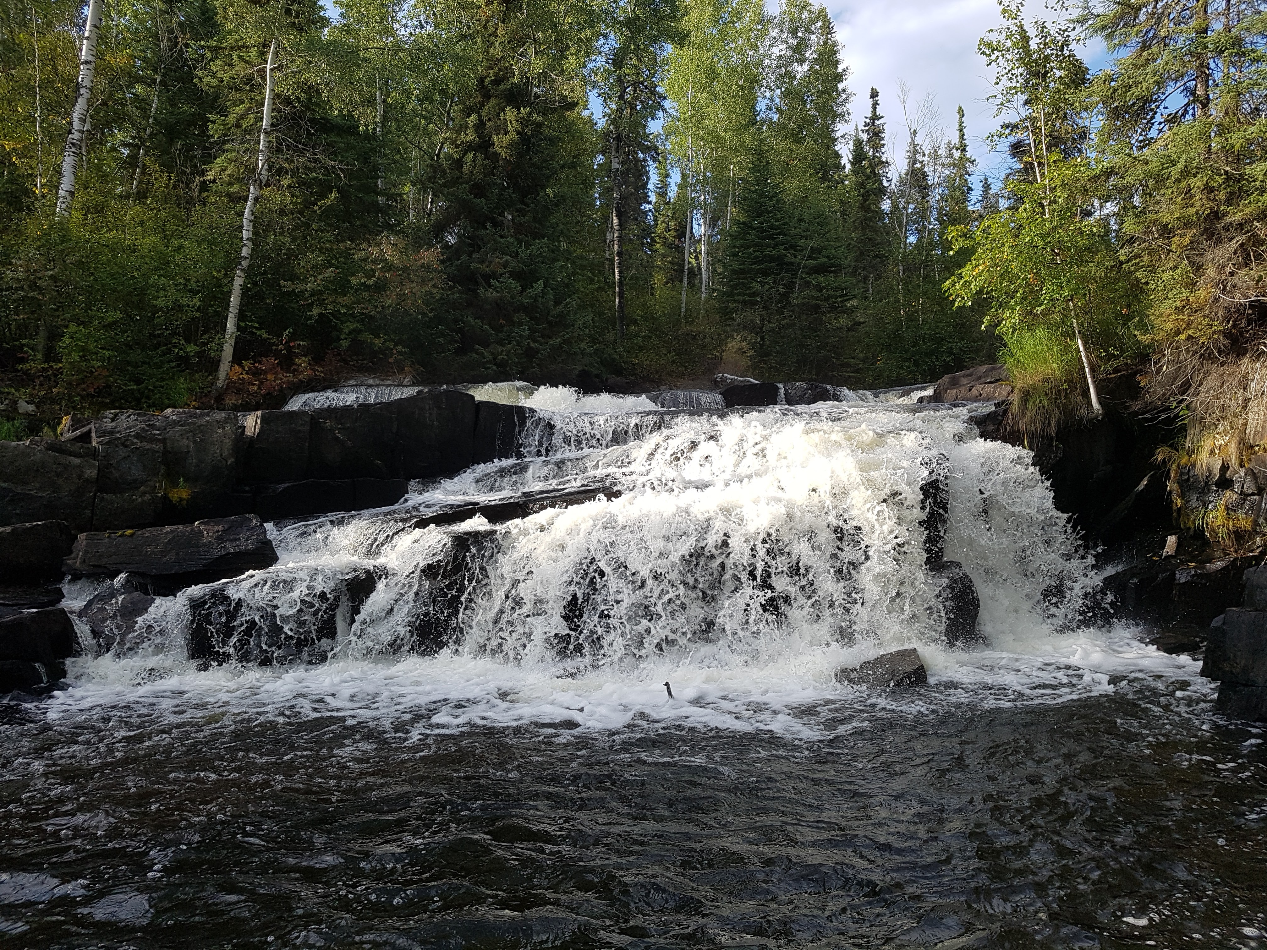
To start the second day, we paddled to the north end of Larocque Lake, viewing the remarkable pictographs along the way. These are the second-most impressive pictographs that I've ever seen (the most impressive ones were between Hickson and Maribelli Lakes, en route to the Paull River). We portaged into Auld Lake to check out the pictographs there as well, then checked out where the Weaver flows via a stony rapid and waterfall into Larocque Lake. Before seeing it, we optimistically thought maybe we could line the canoes or do a short carry over the rocks back down to Larocque but upon getting there we realized that would be either impossible or treacherous, and very much not worth it. There was a little rapid up above the falls a hundred meters or so and I was able to run one canoe through that, then we ferried the other 2 paddlers down the rest of the way to the waterfall. After checking out the falls from above, we headed back to the portage and proceeded back to Larocque Lake and our campsite from the previous night for snacks and to pick up our gear. From there we continued on to Forbes Lake via the short portage.  

Looking toward the drop from Auld Lake to Larocque. This is typical of the Weaver - rocky with a significant drop between lakes. It did get larger in volume by Standunder Falls and Clark Falls, but it's still a pretty small river. 


Rob must've been telling quite the story...


Some of the pictographs on Larocque Lake.


That second night we camped on Forbes Lake toward it's southern end. The GoTrekkers map merely mentions that "camping opportunities" exist on the islands in the southern portion of Forbes. We didn't see much in the way of "opportunities" at all on Forbes, but did find a fantastic campsite on the SW corner of MacMillan Island. There may be other spots, but that's a good one to keep in mind for sure.  

Meatloaf cooking in the dutch oven. 


The northern lights were spectacular for a short while, then faded to the background.


Our third day saw us do a few portages to get onto Bellows Lake and a fantastic spot on the eastern tip of Champagne Island. We avoided one portage by running and lining a rapid where a mining road used to cross the Weaver River. It was pretty tight to get down at the current low flows. In a higher water year it would've been easier, I'm sure. Running that small, shallow, rocky rapids had such a tight turn that Rod and Jay got stuck at the top and had to do a multi-point turn to get around and through, though once through that tight spot they were good all the way down the rest of the rapid. Rob and I managed that first tight turn all right, but then got stuck midway down and turned sideways to the current. That small rapid proved pretty damn powerful and the canoe was at risk of filling up, but we were able to step out and line the rest of the rapid. We spent some time at Standunder Falls where the Weaver flows into Bellows Lake. Only Jay was brave enough stand under Standunder Falls - it was a pretty tight fit and it was damn cold.  

Rob directing Jay and Rod on where to go through this tight rapid. 


This might've been while they were backing up to get through the tight corner.


On our fourth day we portaged around Clark Falls and the end of the Weaver River at Hayman Lake on the Churchill River. We completed the 1 km portage around Sluice and camped near bottom of the portage beside Sluice Falls. It's a large site and quite nice though it suffered a big blow down several years ago (after which my buddies and I spent some time and effort clearing the portage and campsite with chainsaws). Once camp was set up in late afternoon it was time to fish since fish was on the menu. It took a while but I caught a nice size walleye and a small one, which together with another two small ones made a nice feast for supper.  


Our fifth and last day had us paddle out to Missinipe. Rob and Bryan did the short carry at Ric's Falls to bypass Corner Rapids and Rod and Jay ran Corner. They took some water on and had a pretty good ride and so Rob and I decided not to chance it and did the carry instead. From there we went down the channel to Dieter Rapids and out onto Barker Lake. We checked out the new composting toilet which will hopefully help mitigate the poop impact that this busy area sees. Since it was Tuesday after the long weekend in September, we had the entire area to ourselves. Actually, it wasn't until we left Barker via the 3 Sisters Rapids route and got past Staircase Falls that we saw the first other paddlers of the trip. Those paddlers were on Devil Lake near the launch. On the Weaver itself we'd seen a couple of motorboats with fishermen at Forbes Lake, but otherwise no-one. At Otter Rapids we ran the rapids using the sneak route tight to river left and got down onto Otter Lake mostly without trouble (don't go TOO far left or you might grind to a halt on rocks a few meters from shore). After that it was paddling on Otter Lake toward Osprey Wings in Missinipe. While loading up, Gary Thomson shared many jokes with us then invited us into his office so that we could each select a couple prints of his paintings. With canoes loaded and prints in hand, we drove back home to Saskatoon and were tucked in bed well before midnight.   


There are not a lot of resources out there for the Weaver River. The best current resource is the GoTrekkers map produced in conjunction with Churchill River Canoe Outfitters. Be advised that the information on the GoTrekkers maps often has errors (campsites that are fictional, portages that are misplaced). In this case, not all of the marked campsites exist and others are unmarked. Also, in this case they've placed it at about 45° so that NE is up, presumably so that the river fits on less paper. The writing is all still horizontal. The result for me was that my perspective on the map and the land was all skewed and I had to constantly adjust the direction that I thought I was looking or paddling. The scale is 1:40,000 so it's a bit off from what I'm used to in topographic maps. Still, it's the best resource currently available. Find it here: https://www.canoemapscanada.com/products/weaver-river-sk.html

Here are some much better photos that Rob (an actual photographer) posted: https://www.facebook.com/media/set/?vanity=robertkunz&set=a.10208482231570121    

Well, would you lookat that, I wasn't going to write a report, I was just going to post a link to some pictures on facebook, but there we are, a report seems to have happened.  

Cheers, 

Bryan

Toporama

I keep forgetting where to find this, so I might as well make a blog post so that you and I can both find it.

The Government of Canada's Toporama mapping site is a handy resource for trip planning. It lets you view the topographic maps for anywhere in Canada. https://atlas.gc.ca/toporama/en/index.html

This link should take you right to the Weaver River, for example: Weaver River Map (Forbes Lake to Weaver Lake section). 

You can select and print off your map areas, which is nice. There are also measurement tools. 


a

Monday, October 6, 2014

Run Down Sluice Falls by Fishing Boat

I saw this on facebook this morning. It is a local fishing guide running down the Sluice Falls channel and avoiding the 1 km portage I've slogged over a few times. It was great to see the rapids from this perspective.


Tuesday, September 2, 2014

How to Survive after a Paddling Accident

This has also been posted on Bryan's other blog at http://pawistik.blogspot.ca/

Last week while packing for the annual NSE canoe trip I was contacted by Global Saskatoon to comment on how to survive after a mishap on a paddling trip. In addition to being a paddling instructor, I am the Paddle Canada representative for Saskatchewan, and am a co-author of the AdventureSmart paddling safety awareness program called PaddleSmart.

The interview follows on the recent tragic death of David Dice along the Churchill River, a section that NSE paddled in 2010. I do not know the details of what happened, but according to news reports David was found below Needle Falls on Kinosaskaw Lake. Shortly after David was found by fishermen, his wife Enid Dice was found upriver somewhere along Needle Rapids. She had been there without supplies for 8 days. The reports don't offer much for details, though they do mention she had a fire going (it will make your life easier to have some reliable means of starting a fire on your life jacket or in a pocket, and redundancy is good!). The Dices are very experienced outdoorspeople and paddlers, and David's early death is a loss to the paddling community. My condolences go out to all of those grieving David's death.

http://globalnews.ca/video/1533357/surviving-eight-days-in-the-wilderness


A few more details were reported via CBC: http://www.cbc.ca/news/canada/saskatchewan/details-emerge-on-sask-couple-s-tragic-canoe-adventure-1.2750011
One of the first people to speak to Enid after the ordeal was Ric Driediger, owner of Churchill River Canoe Outfitters, who was also one of the last people to see the couple before they set out on their trip.
He says he learned, from Enid, that the couple's canoe capsized as they were navigating a set of rapids on the lake known as Needle Falls*.
They were separated and Enid swam to shore with her husband's backpack that had a sleeping bag and an emergency fire-starting kit. There was no food, however.
*I wonder if this statement as reported is correct. It seems more likely that they were running Needle Rapids (C2+ to C3), about 2.25 km above the falls, or the outlet from Sandfly lake (C3), a further 1 km above Needle Rapids. It seems unlikely that they would have been running the falls (C5), but the earlier sets of rapids are manageable for the canoeist with skills in rapids. This also makes sense since Enid had no gear other than what she swam to shore with and was separated from her husband who was reportedly found on Kinosaskaw Lake in the eddy below the falls. Were the capsize to actually have occurred at the falls, she would have been mere meters from her late husband, the overturned canoe and much of the gear including the SPOT. 

A map of the region:

Open this map full screen.

Aerial view of the rapids at the outlet of Sandfly Lake. We portaged these.

Class 3 rapids at the outlet of Sandfly Lake.

Uppermost portion of Needle Rapids from the spot where we scouted the set. This is the river left channel. 

Jay & Rod scouting Needle Rapids. 


David & Enid's Blog: David and Enid's Travels


Here are some items you should consider having with you, or on you, whenever you head out paddling. Most of these items can be fit into a small pouch that can be attached to the life jacket or contained in a pocket. These items are described as "The Essentials Plus" in the PaddleSmart program:
  • Transport Canada Required Items:
    1. Life jacket
    2. Whistle
    3. Throw bag
    4. Bailer
    5. Waterproof flashlight
  • Other Essential Items:
    1. Fire making kit
    2. Signalling device (e.g. whistle, signal mirror)
    3. Extra food and water
    4. Extra clothing
    5. Navigation & communication devices
    6. First aid
    7. Emergency blanket or shelter
    8. Knife
    9. Sun protection
In the pocket of my PFD I have a small pouch that in the video linked above has had the contents spread out. The contents include a signal mirror, granola bar, fishing line, snare wire, ~20' of thin cord, orange bandana, emergency blanket, lighter, & fire starter. In the canoe or kayak I also almost always have extra clothing, rain gear, some form of shelter (tarp &/or a bothy bag), extra food, water (though we can usually drink our water from the lake), first aid kit, more lighters, matches and fire starting stuff. 

Tuesday, August 26, 2014

Beef Jerky

Time is running out before our 2014 NSE trip (this year it's Surf City on the Churchill River near Missinipe, SK) and I still have to pack and get everything ready. On my "To-Do" list is smoking & drying the jerky for our trip. On Sunday I bought 2 round roasts (5 lbs of meat in total?), sliced them up and marinated them in a homemade teryaki sauce with jerky cure. This evening (Tuesday) they will go into the smoker using this smoke schedule from the Bradley Smoker website:

  1. Dry at 140°F without smoke until the meat is dry (~ 1 hour)
  2. Smoke at 160°F for 2-3 hours
  3. Dry at 175°F until done - about 3 hours.
The sauce I used was gleaned and modified from a couple of different websites and spiced up some, but basically went something like this:
  • 1 cup of soy sauce
  • 1/4 cup white wine (since I didn't have any rice wine or whatever was called for)
  • a couple tablespoons of fresh ginger
  • a fair bit of honey to sweeten the mixture to taste - maybe 1/4 cup or more
  • minced garlic
  • onion powder
  • cayenne
  • ground pepper
  • chili flakes
The sauce was heated to dissolve the honey, then cooled in the freezer before use. Just prior to marinating the meat with the sauce, I added an appropriate amount of cure based on the instructions (just shy of 2 tsp).

Rather than finish in the smoker, I pulled the jerky out after smoking and finished in the dehydrator. The smoker doesn't offer very even heat, getting hot along the back above the burner (some folks install a small fan which would be great in this application). Because the meat is thin it is prone to quickly overcooking in some areas along the back and I would have to counter this by frequently rotating the racks and meat. Since it was late (~11 pm), I decided to finish the drying process on the dehydrator, set to 160°F. I connected the dehydrator to a block heater timer so that it would dry for about 3 hours, be off for the rest of the night, then start up again in the morning to finish it off. I find that second drying step is helpful with a lot of foods - the moisture becomes "trapped" inside the dried outer parts, and takes a very long time to dry properly. By giving the food a bit of a break, the moisture moves outward and becomes more even through the product. Then, a short period of drying (~1 hour in this case) finishes off the product and ensures it is sufficiently dry all the way through.

Smoker set up and ready to go.

5 racks of jerky ready to start the drying step.
The finished product the next morning.

Wednesday, August 13, 2014

Kayak Asshole

This is pretty hilarious. Enjoy! Thanks to the Kayak Yak blog for sharing! http://kayakyak.blogspot.ca/2014/08/kayak-asshole.html

Wednesday, August 6, 2014

Inspiration for Rod

NSE member Rod often tells the story of falling a large tree in his back yard much to his neighbour's chagrin. Well, we think Rod will enjoy this precision tree-falling video.

Tuesday, July 22, 2014

CRCO Whitewater Festival

Northstar Expeditions had a great meeting in Bryan's back yard last night working on canoe outfitting and discussion various trip issues.

Here is a just-released fun video showing some of the awesomeness of the Churchill River Whitewater Festival. I keep missing it but the event is growing and just as cool as ever. NSE should plan to attend in 2015, maybe we could show those young whitewater punks a thing or two.


Whitewater Festival 2014 from McKinno on Vimeo.
Churchill River Canoe Outfitter's annual whitewater festival. Shot over the Canada Day Long Weekend at Surf City, Staircase Falls, Sluice Falls, The Shelf and Barker Island. A big thanks to CRCO for putting on the festival and to Canoe Kayak Saskatchewan for sending me!

Includes the song "The Walker" by Fitz and the Tantrums

Thursday, October 31, 2013

Hey, I Re-Invented Something...

This one's for Rod, who comes up with something genius at least once a trip. And, unfortunately we have to let him know it's already been done.

http://dilbert.com/strips/comic/2013-10-12/


Wednesday, October 16, 2013

Friday, August 9, 2013

The Official Beer of NSE

Might as well stick with the beer theme. Though we've never had it, AC/DC Beer is now the official beer of Northstar Expeditions.


Thursday, August 8, 2013

Where to Go, 2013 Edition

We have 4 days, plus driving up the previous evening. Here are some options I've got rolling around in my brain and that I've been discussing with the group:
  • Option 1.1: Upper Sturgeon-Weir River, from Pelican Narrows to Pawistik Lodge on the Hanson Lake Road (Hwy 106). Not very long (50 km), 3 portages around small falls and rapids, sections of swift water. Simple shuttle can probably be arranged via Pawistik Lodge or another area outfitter. I expect typical shield scenery. 
    • Option 1.2: Adding another 50 km to the above, paddling from Jan Lake Lodge to Pelican Narrows. Big water, lots of islands. 
  • Option 2: Lower Sturgeon-Weir, from Denare Beach on Amisk Lake to Sturgeon Landing. Paddling off the shield on the lake onto limestone benches of the river with lots of fossils. Starting at Denare Beach, this is 30km of mostly open lake followed by 38 km of river. River is many small rapids with 2 larger rapids that can be portaged if needed. 
  • Option 3: McLennan Lake area. Fish, new area. 
  • Option 4: Surf City, Corner Rapids. Need I say more?
  • Option 5: Montreal River, Montreal Lake to Hwy 165 Bridge, 66 km. Continuing to Air Ronge brings total distance to 146 km.  Current flows are over 60 cubic m/s; we would want that to drop some, maybe to about 40. Considering this is a spring river, this could be a once-in-a-lifetime chance to run it in September. Never mind that it's been runnable in the fall probably 4 of the last 5 years. 
  • Option 6: Lac LaRonge by kayak. I need more big water kayak camping experience before I go for my Level 3 certification. LaRonge past Nut Point, Wadin Bay, Jay's uncle's cabin or just explore the islands. Head to Hunter Bay. 
Bryan's favourites, in order:
  1. Option 2 Lower S-W
  2. Option 5 Montreal R.
  3. Option 1.1 or 1.2
  4. Option 6 Lac La Ronge
  5. Option 4 Corner Rapids
  6. Option 5 McLennan Lake